Jegunovce
Jegunovce is one of the larger villages in the Polog Valley, North Macedonia. It is located about 10 mi (15 km) northeast of the Macedonian city of Tetovo. It is the center of the Jegunovce Municipality.
Jegunovce began to grow from a village into a small town after World War II, when the new Yugoslav government under Josip Broz Tito built a massive metallurgical plant (working mostly with chromium) in the area. The plant was named Jugohrom, and was one of the largest employers in Yugoslavia. The plant was renamed Silmak in 2002, and closed in 2006. After reopening and closing later on again in early 2009 due to the world financial crisis and rapid decline in demand, Silmak started its operations again in July, 2009.
Jegunovce began to grow from a village into a small town after World War II, when the new Yugoslav government under Josip Broz Tito built a massive metallurgical plant (working mostly with chromium) in the area. The plant was named Jugohrom, and was one of the largest employers in Yugoslavia. The plant was renamed Silmak in 2002, and closed in 2006. After reopening and closing later on again in early 2009 due to the world financial crisis and rapid decline in demand, Silmak started its operations again in July, 2009.
Map - Jegunovce
Map


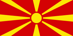
Country - Republic_of_Macedonia
 |
 |
The region's history begins with the kingdom of Paeonia, a mixed Thraco-Illyrian polity. In the late sixth century BC, the area was subjugated by the Persian Achaemenid Empire, then incorporated into the Kingdom of Macedonia in the fourth century BC. The Roman Republic conquered the region in the second century BC and made it part of the larger province of Macedonia. The area remained part of the Byzantine Empire, but was often raided and settled by Slavic tribes beginning in the sixth century of the Christian era. Following centuries of contention between the Bulgarian, Byzantine, and Serbian Empires, it was part of the Ottoman Empire from the mid-14th until the early 20th century, when, following the Balkan Wars of 1912 and 1913, the modern territory of North Macedonia came under Serbian rule.
Currency / Language
| ISO | Currency | Symbol | Significant figures |
|---|---|---|---|
| MKD | Macedonian denar | ден | 2 |
| ISO | Language |
|---|---|
| SQ | Albanian language |
| MK | Macedonian language |
| SR | Serbian language |
| TR | Turkish language |